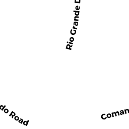
10 DAKOTA DR
Owner Information
WHELAN CAROL A TRUSTEE
10 DAKOTA DR
CHELMSFORD, MA 01824


Property Details
10 DAKOTA DR is classified as a Single Family Residential (Ranch).
The primary structure on this property was built in 1968. There are 3,112ft2 of built area within this property. There is 2,440ft2 of residential/living space within this property. This property is listed as having 8 rooms.
10 DAKOTA DR is valued at $500,000. The land is valued at $288,900 and the structures are valued at $209,900. There is an additional valuation of $1,200 on this property.
This property is in Zone RB. Confirm with local Zoning Board authorities to ensure there are no overlays or other easements on this property.
The most recent deed for 10 DAKOTA DR is recorded at the local registrar in Book 20640, Page 0157. 10 DAKOTA DR was last sold on Friday, October 27, 2006 for $1.
Assessment data from fiscal year 2022.
Flood Data
According to the FEMA National Flood Hazard Layer, this property does not appear to be in a flood zone. It may also be in an area not yet reviewed. Nonetheless, confirm this information prior to taking any action.
To view the flood hazards around this property, create a FEMA "Firmette" Map of the area around 10 DAKOTA DR.
Broadband Internet Providers
| Provider | Type | Bandwidth (mbps) | |
|---|---|---|---|
| GCI Communication Corp. | Satellite | 0 | 0 |
| VSAT Systems, LLC. | Satellite | 2 | 1 |
| HughesNet | Satellite | 25 | 3 |
| Verizon New England Inc. | Fiber | 940 | 880 |
| Viasat Inc | Satellite | 100 | 3 |
| Comcast | Cable | 1000 | 35 |
Broadband service provider data from December 2020.
Adjacent Properties
- 12 DAKOTA DR
Single Family Residential owned by ROGERS GARY E & NANCY J - 6 COMANCHE CR
Single Family Residential owned by MERCADO JULIUS SUROT & - 8 COMANCHE CR
Single Family Residential owned by DECHAVES PETER & - 8 DAKOTA DR
Single Family Residential owned by BUTTERS HELEN L - ELDORADO RD
(formerly Municipalities/Districts. Removed June 2009.) owned by CHELMSFORD TOWN OF